

海の上を走る道
A road that runs above the sea
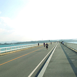
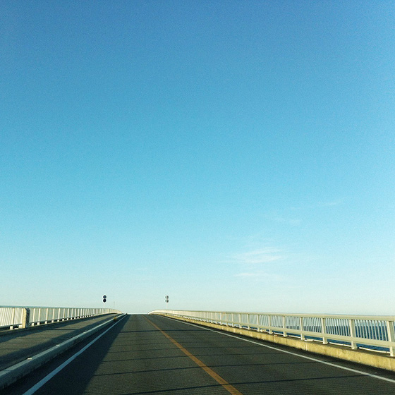
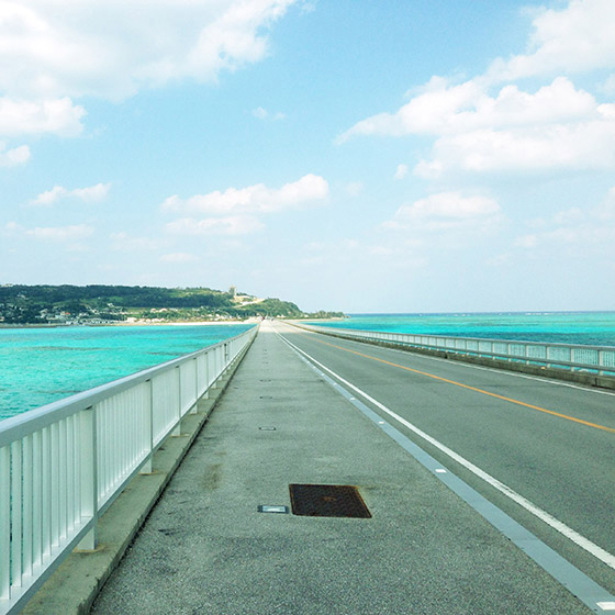
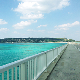
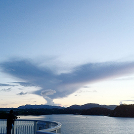
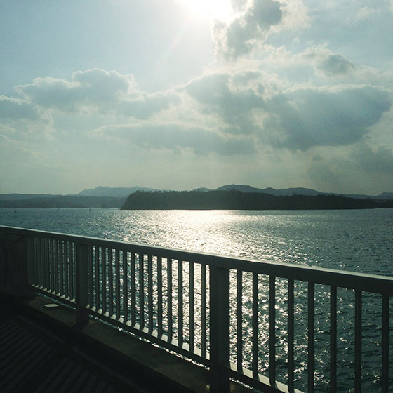
海上を飛んでいるような不思議な錯覚を体験する
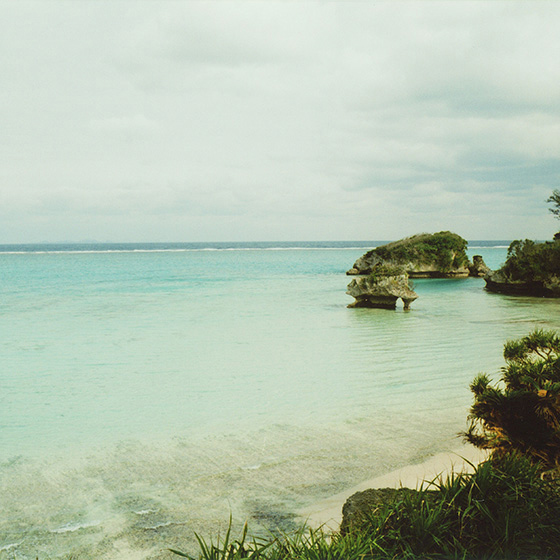
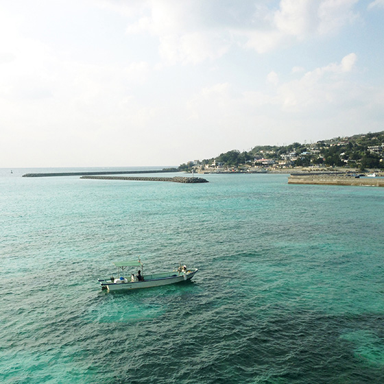
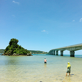
2005年に屋我地島との間に古宇利大橋が開通した古宇利島は、沖縄諸島が琉球王朝に統一されるまで北山王朝が統治していた。「人類発祥の地 ウミナイ(女性)ウミキ(男性)」として知られる沖縄版・アダムとイブ伝説のある島であることから、別名「恋島(くいじま)」と言われ、スピリチュアルパワースポットとして女性を中心とした観光客が多い。
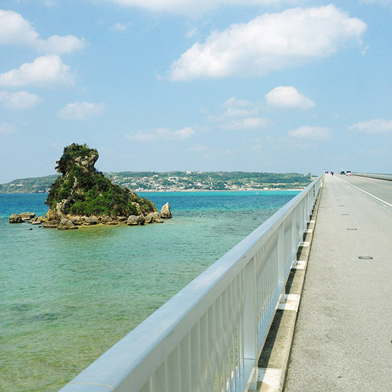
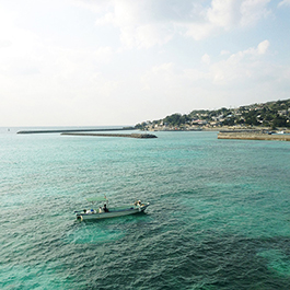
古宇利島一周線は、皇居のように前半やや急坂を登り、島の北側に来ると遠くに伊平屋島・伊是名島を一望しながら島の南側に向かってゆるやかにくだっていく。
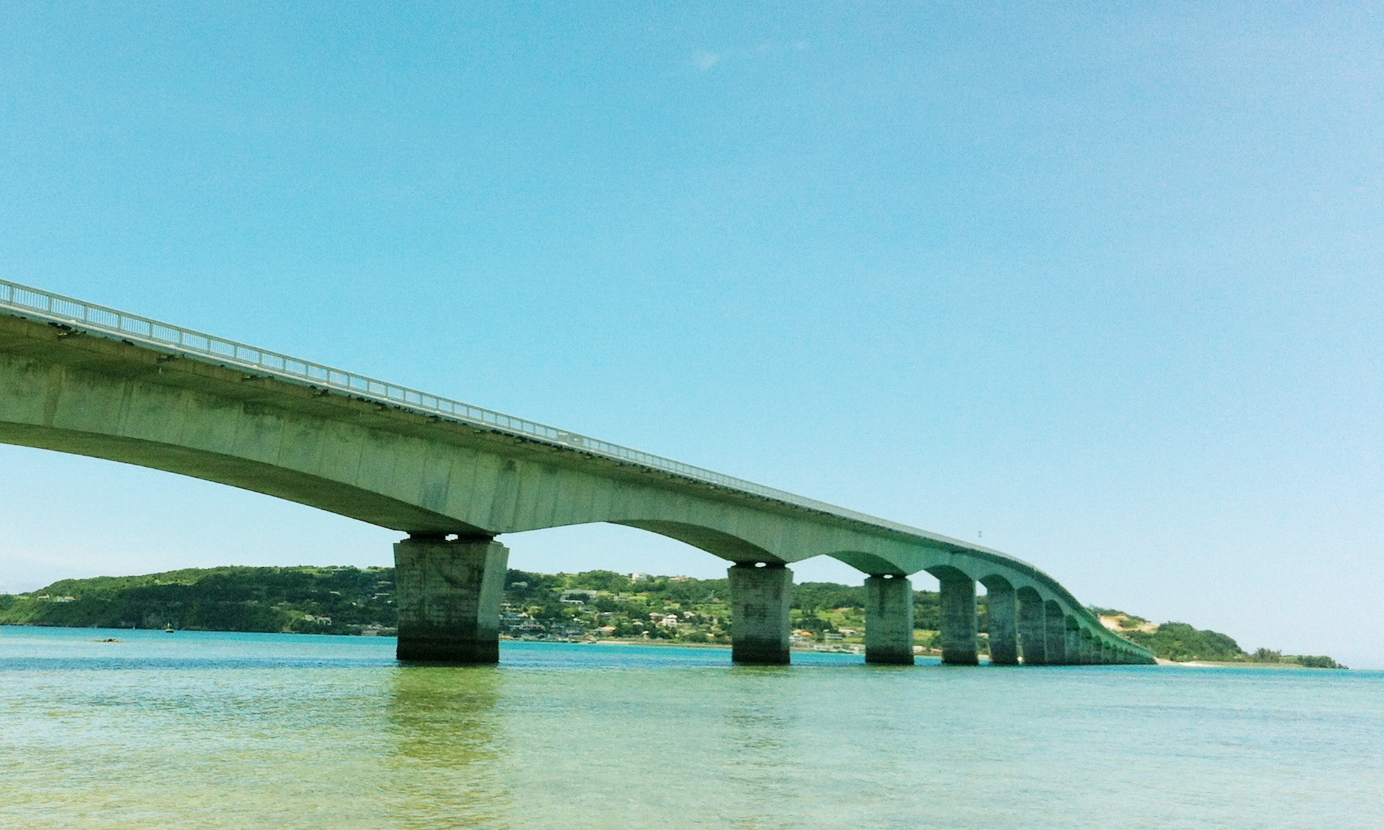
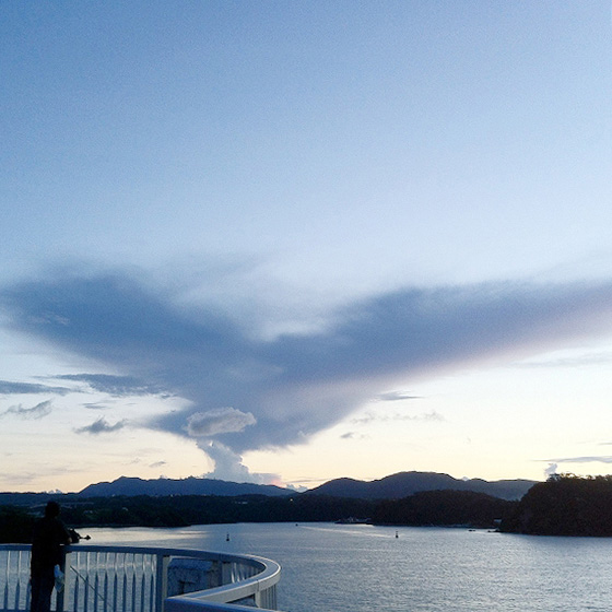
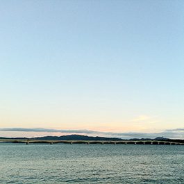
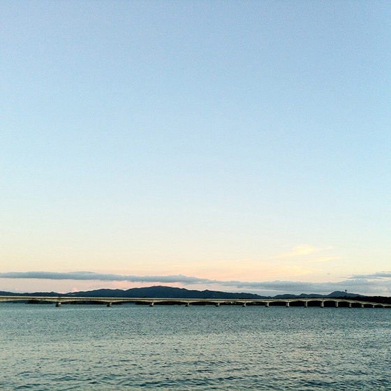
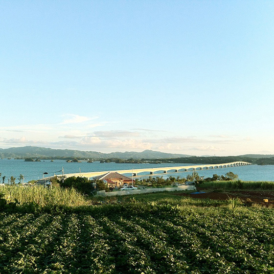
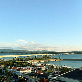
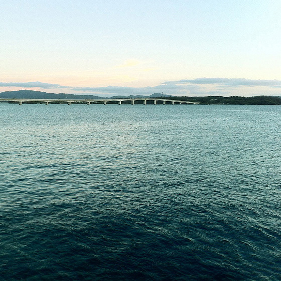
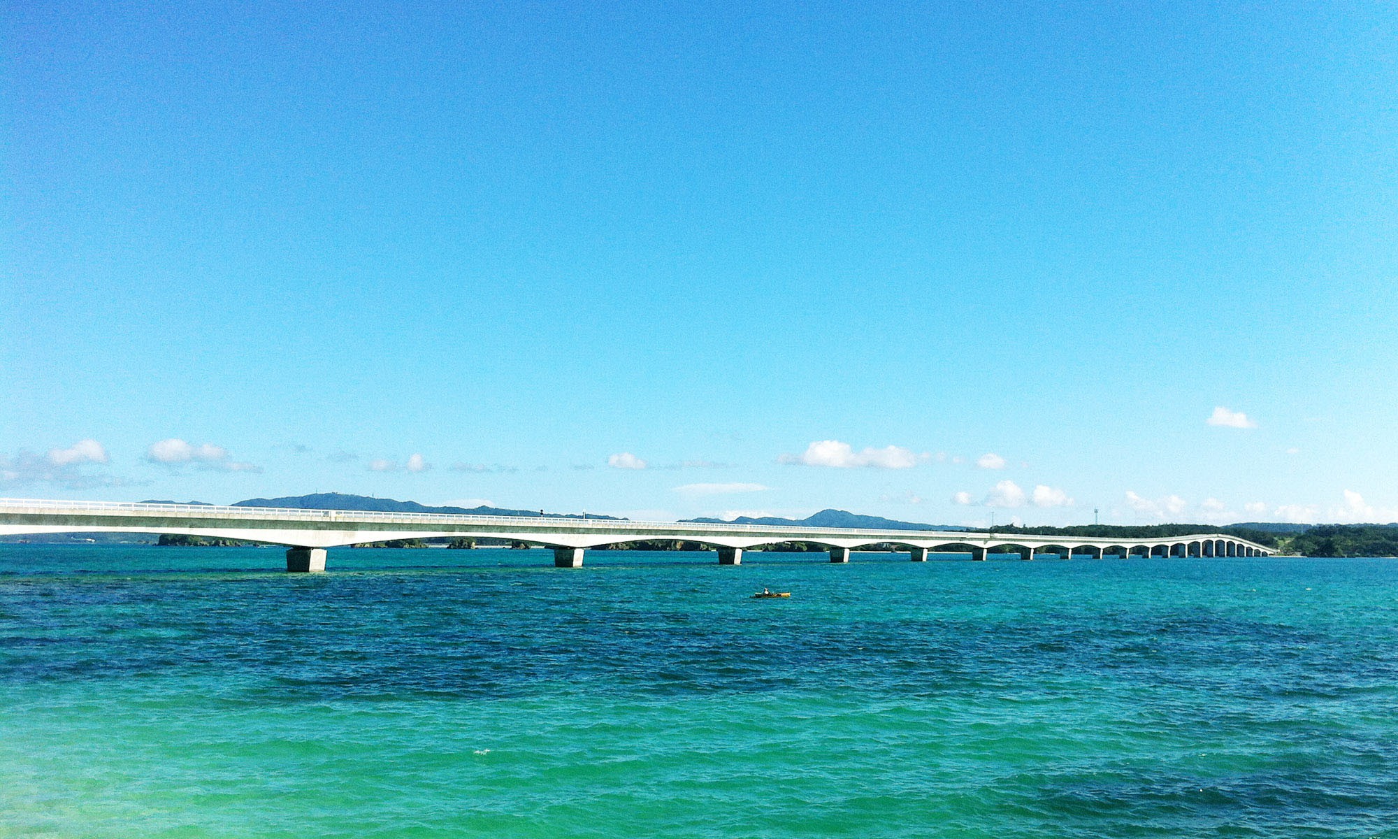
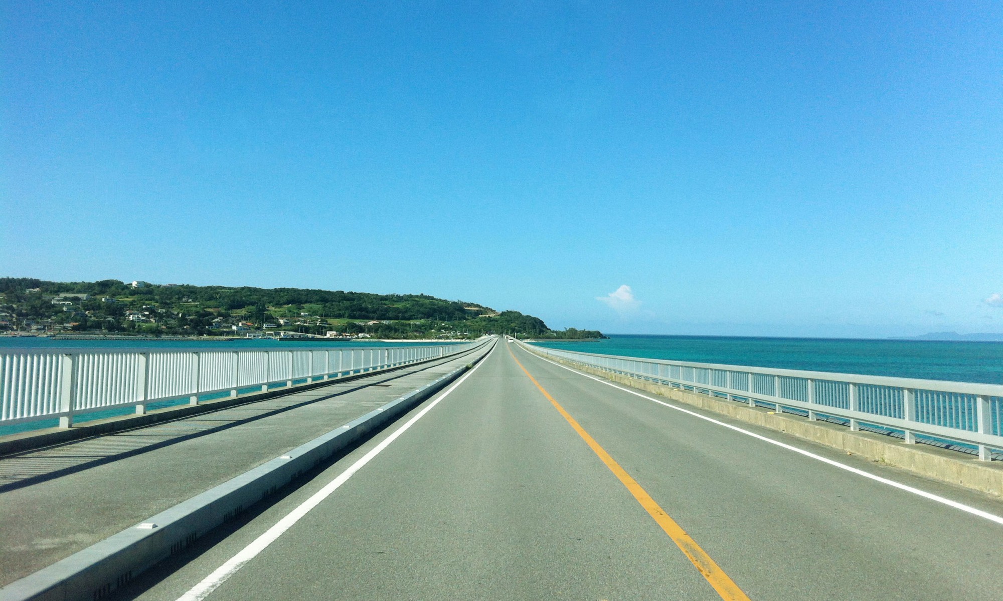
沖縄本島と古宇利島を陸路で繋げる古宇利大橋は、沖縄最長(2011年現在)の橋、で、海上を直線で突き抜ける2キロにも及ぶ橋梁構造から、橋の上は陸地より高い位置にあり、沖縄屈指の絶景ポイントとなる。古宇利島に向かう前半は、まるで海上を飛んでいるような不思議な錯覚を体験するだろう。
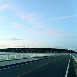
映画やテレビCM等の様々な映像作品のロケ地としても、利用されており、この美しい道を走って、“マジックアワー”の魔法にかかってみてはいかがだろうか。
You'll probably experience the strange illusion that you're really flying over the sea.
Kourijima Island, which was connected to Yagajishima Island in 2005 via the Kouri-Ohashi Bridge, was ruled by the Hokuzan Dynasty until the Okinawa Islands were unified by the Ryukyu Dynasty. Legend has it that the island was the “birthplace of humanity,” home to Uminai (a female) and Umiki (a male), the Okinawan version of Adam and Eve. It is therefore also known by the alternative name of ‘Kuijima’ (Love Island) and is popular with female tourists as a spiritual power spot.
The first half of the lap around Kourijima Island is somewhat steep as is common with roads around an imperial palace, and as you reach the northern end of the island you have a panoramic view of Iheyajima Island and Izenajima Island in the distance. The road gradually slopes downward as you head toward the south end of the island.
Kouri-Ohashi Bridge, which links the main island of Okinawa and Kourijima Island by road, is the longest (as of 2011) bridge in Okinawa. This bridge structure cuts straight across the sea and stretches for as long as 2 kilometers. The bridge is higher than the land, providing one of the best scenic points in Okinawa. While crossing the first half as you head toward Kourijima Island, you’ll probably experience the strange illusion that you’re really flying over the sea.
This bridge is used as the location for various visual works such as movies and television commercials. Why not try driving along this beautiful road and feel the magic of the “Kourijima Magic Hour Run”?
喜久里 忍(スポーツ地産地消プロジェクトインストラクター)
Shinobu Kikuzato (Local Region Sports Project Instructor)

撮影:推薦者提供、塚本哲也、進藤昭洋
撮影:推薦者提供、塚本哲也、進藤昭洋

撮影:推薦者提供、塚本哲也、進藤昭洋

撮影:推薦者提供、塚本哲也、進藤昭洋

撮影:推薦者提供、塚本哲也、進藤昭洋
撮影:推薦者提供、塚本哲也、進藤昭洋

撮影:推薦者提供、塚本哲也、進藤昭洋

撮影:推薦者提供、塚本哲也、進藤昭洋

撮影:推薦者提供、塚本哲也、進藤昭洋
撮影:推薦者提供、塚本哲也、進藤昭洋
撮影:推薦者提供、塚本哲也、進藤昭洋

撮影:推薦者提供、塚本哲也、進藤昭洋

撮影:推薦者提供、塚本哲也、進藤昭洋

撮影:推薦者提供、塚本哲也、進藤昭洋
撮影:推薦者提供、塚本哲也、進藤昭洋

撮影:推薦者提供、塚本哲也、進藤昭洋
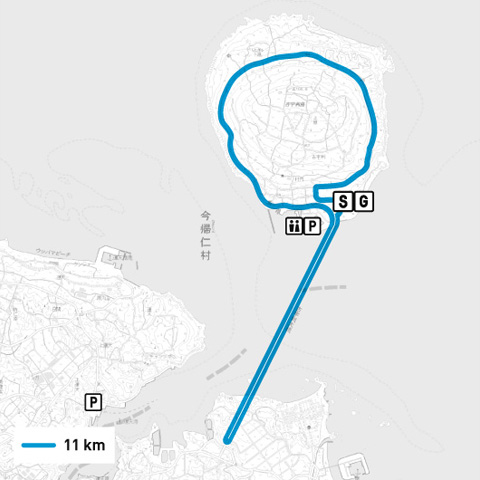
所在地:沖縄県国頭郡今帰仁村・古宇利島
距離:古宇利島1周→古宇利大橋折返し11km
路面:アスファルト
高低差:40m
お薦め季節:春夏秋冬
近隣施設:古宇利島ふれあい広場、世界遺産・今帰仁城跡
平均気温:夏31.8℃、冬19.3℃
緑の多さ:多い
その他:古宇利大橋の開通により出来た道
Location:Kourijima Island, Nakijin Village, Kunigami District, Okinawa Prefecture
Distance:One lap of Kourijima Island→across the Kouri-Ohashi Bridge and back 11km
Road surface:Asphalt
Altitude difference:40m
Recommended seasons:All seasons
Nearby facilities:Kourijima Fureai Hiroba, the ruins of Nakijin Castle (a world heritage site)
Average temperature:31.8°C in summer, 19.3°C in winter
Greenery:Abundant
Road created by the opening of the Kouri-Ohashi Bridge
アクセス :
那覇空港より高速道路で1時間45分
名護市内より車で25分
ACCESS :
1 hour and 45 minutes by expressway from Naha Airport
25 minutes by car from Nago city center
編集:中島茜、能勢賢太郎、谷岡弘邦
撮影:推薦者提供、塚本哲也、進藤昭洋
製作:ランナーズインフォメーション研究所
Editor: Akane Najima, Kentaro Nose, Hirokuni Tanioka
Photographer: Recommender, Tetsuya Tsukamoto, Akihiro Shindo
Production: Runner’s Information Research Institute